20 Dec Dún Dealgan
(Cúchulainn’s Castle)
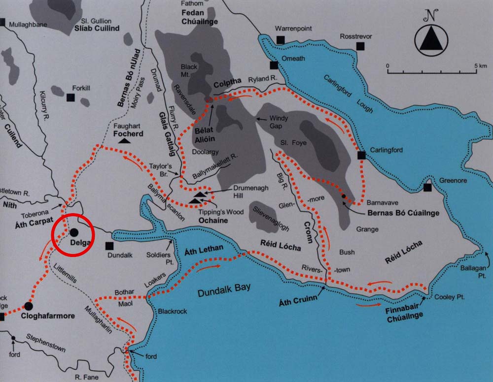
“From Faughart, Medb’s forces followed the Slige Midluachra southwards and crossed the Castletown River (Nith) via Ath Carpat at Toberona. This ford is overlooked by Castletown Mount alias Dun Dealgan alias Delga, held in local tradition to be Cuchulainn’s foster-home.”
Paul Gosling, 2015, referring to events in the Táin Bó Cúailgne 1
Click the image above to enter the virtual-reality tour.
Touch the image above to enter the virtual-reality tour.
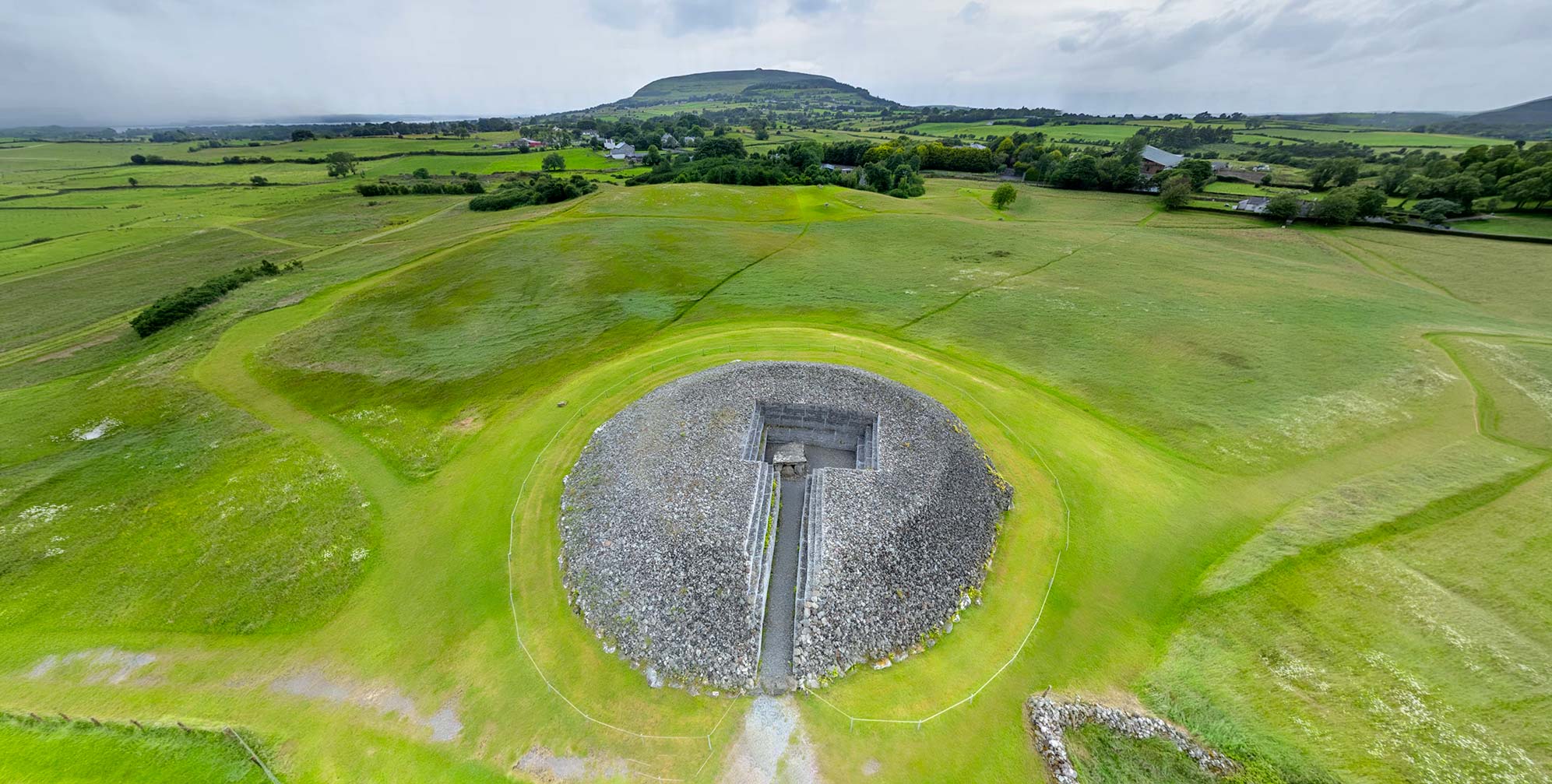
Perched on a commanding ridge overlooking the Castletown River, Dún Dealgan represents one of the most strategically significant sites in Irish history. Known today as Castletown Mount or Cúchulainn’s Castle, this ancient fortress has had an important role in Irish mythology, medieval warfare, and regional power struggles for more than two millennia. The site’s enduring importance stems from its exceptional geographic position that has made it a natural stronghold, a mythological heartland, and a crucial gateway between Ulster and the rest of Ireland throughout the centuries.
Because of its strategic location, not to mention its viewscape, it has seen different periods of occupation, for quite different purposes. The first references to the site, in early medieval texts, refer to it as “Delga,” and some sources suggest that it may originally have been a prehistoric burial mound.2 The word “Dún” (fort) is only noted after 1002, thus it may be likely that a simple ringfort was built on the hill around that time. Dún Delga, of course, gave its name to the city of Dundalk.
A pre-Norman souterrain, perhaps dating from the time of the site’s original ringfort, has an exit set on the exterior motte wall. It measured 17m (56 ft.) in length but has been walled up and is no longer accessible.
")
Around two centuries later, the Normans constructed a substantial motte-and-bailey military frontier encampment on the site, giving it the conical shape it retains today.
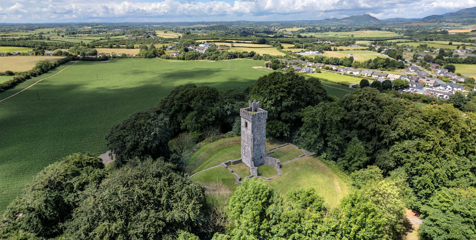
Long after the wooden tower of the Normans had turned to dust, a local entrepreneur of dubious character in 1780 constructed a Gothic house with two towers, one circular and one rectangular. With that, a military fortification chosen for its strategic prominence was converted into a residential property with an especially scenic view.
In 1850, an Irish Whig politician rebuilt the house as a country retreat for his family. After its abandonment and decline, the house was purchased for conversion into a local history museum. Unfortunately, it was destroyed during civil war hostilities, leaving only the remaining rectangular Gothic tower, known as “Pirate Byrne’s Folly,” seen on the hill today.
The Power and the View
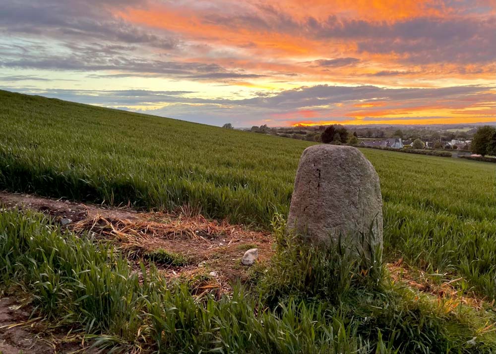
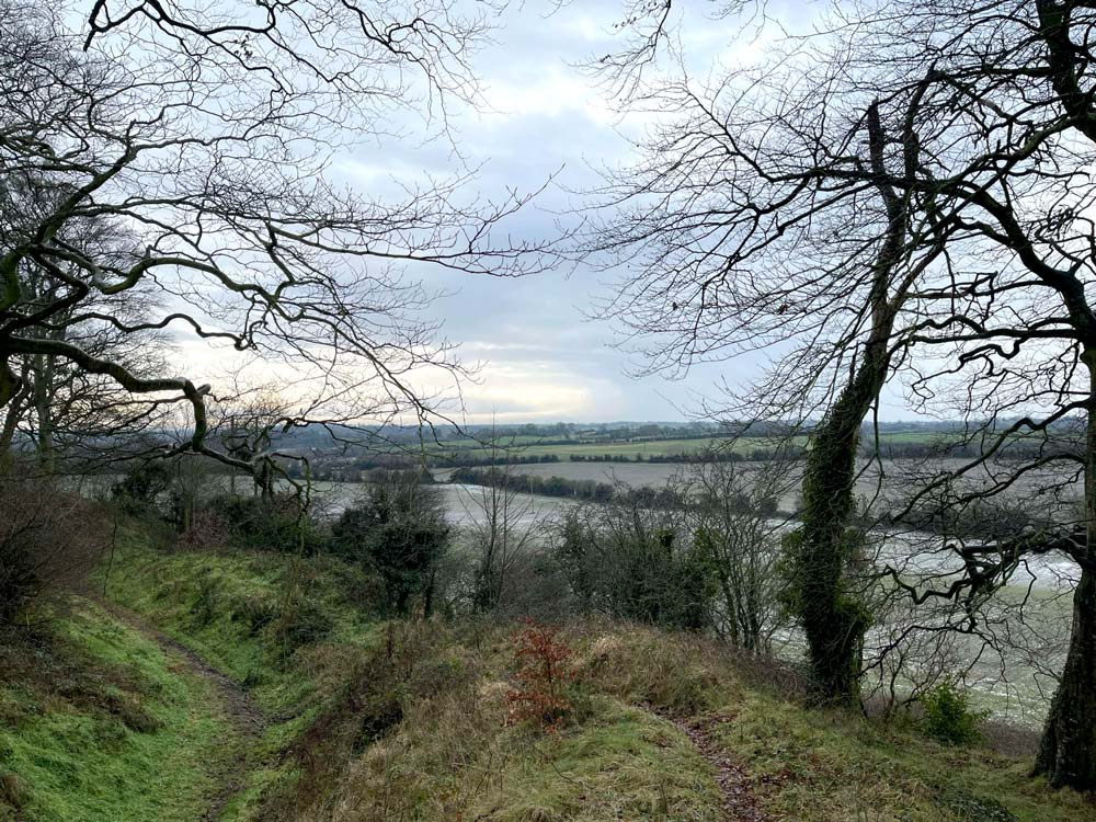
The strategic value of Dún Dealgan begins with its topography. Situated approximately 60m (200 ft.) above sea level on a ridge northwest of modern Dundalk, the site commands sweeping views across the surrounding landscape. The site overlooks the important river ford at Toberona across which ran the major routeway to Ulster through the Moyry Pass. This made Dún Dealgan a natural control point for one of Ireland’s most important ancient highways, the Slige Midlúachra, which connected Tara in the south to Emain Macha (modern Armagh) in the north.3 This vantage point allowed whoever controlled Dún Dealgan to monitor and potentially control movement along this crucial north-south corridor. The site’s clear view to the Castletown River may have also been of strategic importance, as the river provided both a natural defensive barrier and a water route to the sea at Dundalk Bay.4
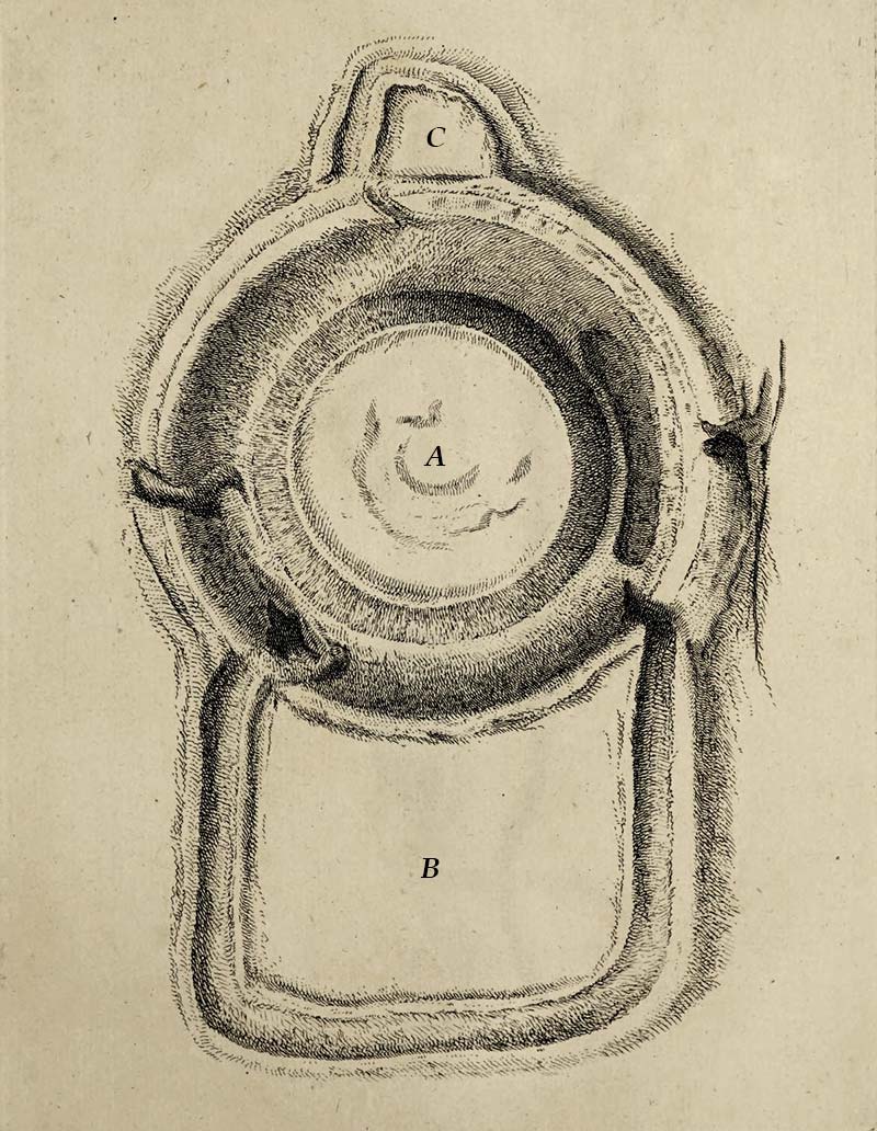
“This Is a very remarkable Mount, and an undoubted Station of the Danes [Vikings], situated upon an Eminence near Castle-Town, and is a bold Point of View to all the Plains about Dundalk, commands a full View of the Bay, and great Part of the Country round about it.
The Mount A, or chief Guard, appears to be all artificial, and is surrounded with a magnificent Ditch. The Height of the Terrace Work in the Middle from the Plane of the Trench is in some Places 50 Feet, and the Circumference of the Top is upwards of 460. Upon the East and West Side of it, are two other Forts, or Redoubts (B and C) adjoining to the outward Vallum of the Ditch, as represented in the Plan which, together with the main Mount A, cover all the Summit of the Hill upon which they stand, and for several Miles to the North and South, make a very formidable and grand Appearance.” 5
The quotation above, referring to the plan (left), is from Louthiana (1748) by Thomas Wright. It is the only visual record of Dún Dealgan’s appearance prior to the 1780 construction of “Byrne’s Folly” on top of the motte. The book also contains a perspective illustration of the fort and its standing stone, which may be seen here.
Mythological Origins and Early Settlement
The name of the fort may come from Dealga, according to Eugene O’Curry, “a chieftain of the Firbolgs who built it.” 6
The earliest direct mention of Dún Dealgan in the Annals of the Four Masters was for the year 332 CE:
“A battle was gained at Dealga, by Eochaidh muigh Meadhoin, over the Ultonians. In this battle was slain the son of Ros Ruadh, son of Rudhraighe.” 7
")
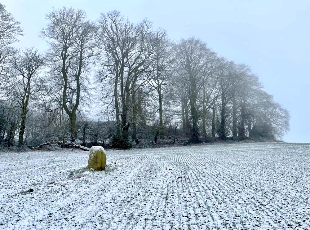
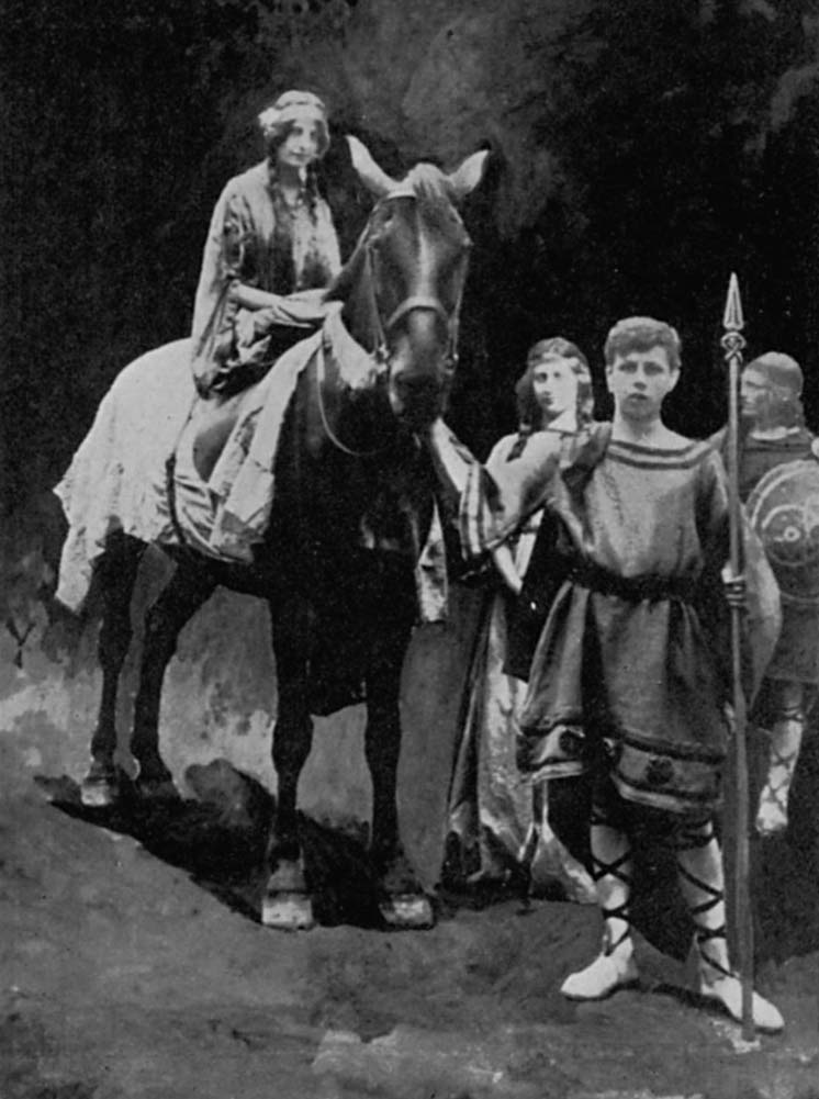
The site’s most famous mythological association is with Cúchulainn, the legendary hero of the Ulster Cycle. In the epic Táin Bó Cúailnge (The Cattle Raid of Cooley), Dún Dealgan serves as Cúchulainn’s primary base of operations. Later folklore and local tradition claim the site as the birthplace of the hero; a standing stone just beneath the fort is identified as marking the spot.8 From the height, Cúchulainn could monitor Queen Medb’s approaching forces and position himself to defend the crucial river crossing that controlled access to Ulster.9 This ford of the Castletown River is noted in our VR tour.
Norman Strategic Vision
The Norman conquest of Ireland in the late 12th century brought a new military perspective to Dún Dealgan. Around 1190, Bertram de Verdun, granted extensive lands in Counties Louth and Armagh, chose this ancient site for his principal stronghold. The Normans understood that whoever controlled Dún Dealgan controlled the northern approaches to the rich agricultural lands of Louth and Meath.10
The Normans constructed an important motte-and-bailey castle on the site (see illustration below), with a massive central mound, approximately 68m (223 ft.) in diameter at the base and 45m (148 ft.) across the flat top, standing some 8-10m (26-33 ft.) above the bottom of a broad U-shaped fosse (ditch). This earthwork was designed not just for defense but as a statement of Norman power visible for miles around.
The castle’s strategic importance is evident in its early political history, as it served as a stronghold of Hugh de Lacy, 1st Earl of Ulster in 1210. He left it when pursued northwards by King John.

A Medieval Frontier Fortress
As Norman control in Ireland waned during the later Middle Ages, Dún Dealgan’s location took on even greater significance. The site became part of what would later be known as “the northernmost outpost of The Pale,” the area of English control around Dublin. The town that grew up around the fortress served as the gateway between the Anglo-Norman territories and the land of the indigenous Irish beyond.11
Initially, the Normans built their settlement directly around Dún Dealgan, creating what became known as the “old town of the castle of Dundalk.” 12 However, by the early 13th century, they had established a “newtown” on the coastal plain to the east, closer to the bay and its developing port facilities.
Between 1300 and 1600 there were some fourteen separate assaults or demands for tribute on the town by those “beyond the Pale.” The period from 1423 to 1444 was particularly challenging, with the town being “assaulted twice by the O’Neills and O’Donnells, and its inhabitants had to pay substantial tributes to the same gentlemen on three separate occasions.” 13
This constant military pressure led to extensive fortification of the medieval town that grew around Dún Dealgan, with substantial town walls, gates, and towers.
At that point, with the shift away from the town’s dependence upon the strength of Dún Dealgan, we can only presume that the wooden tower of the Normans became a long-ago memory and the site faded into obscurity.
The Pirate on the Hill
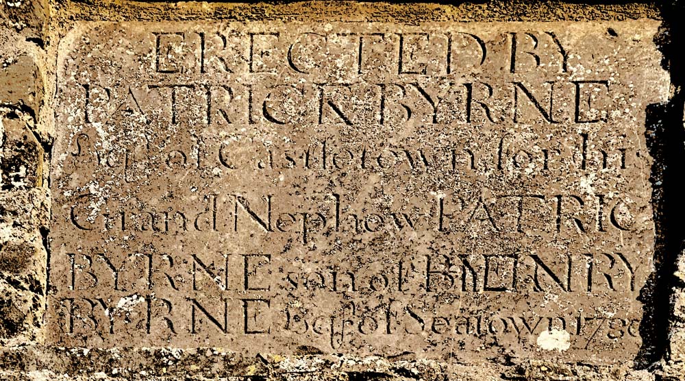
Several hundred years later, Patrick Byrne, a local landowner and merchant, who referred to himself as the “Earl of Castletown,” built atop the ancient mound a Gothic-style house. A gift for his nephew, the structure included a three-story hexagonal gazebo with an adjoining entrance and a rectangular tower. Byrne also had a salt factory on the banks of the Castletown River, where the Bord na Móna peat facility is found today. It may be that he used his salt factory, and a small dock upriver at Saltown (close to Dún Dealgan), to facilitate the work that was the primary source of his wealth: smuggling.
It was said that he built large, deep cellars underneath his home to hide the wine and lace on which he avoiding paying any taxes. According to this story, the souterrain in the fort was in fact a secret passage that ran from Byrne’s tower to his house by the dock at Saltown, more than 700m (780 yds.) away.14
In local lore he is known as “Pirate Byrne,” and the one tower remaining from his 1780 home on the hill is known as “Pirate Byrne’s Folly.” One legend has Byrne hanging a lamp on his tower at night to make it resemble a coastal lighthouse, which would lure ships up the river until they would run aground near his home. Then he and his fellow pirates would claim their booty. The story goes on to warn that “…[the treasure] is guarded by a magic cat, and you’ve got to shoot him with a silver bullet before he’ll let you get it.” 15
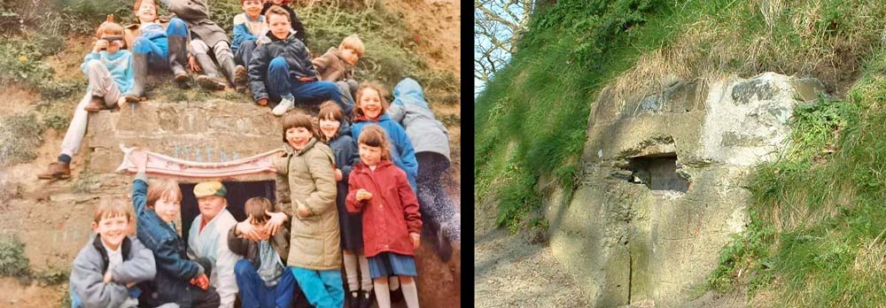
Another Byrne legend concerns his tomb. He was buried in Castletown’s Old Cemetery, in a mausoleum built to resemble a small house. But according to local folklore, every attempt to put the roof on the house ended in failure; each time a roof was built, it would mysteriously collapse in the middle of the night, supposedly as a supernatural punishment for the life of crime attributed to the “pirate.” To this date the mausoleum is roofless, and at the moment (2025) completely overgrown (right).16
Though feared and perhaps disliked during his time, Byrne was a smuggler whose tales have grown to legendary skull-and-crossbones proportions over the centuries. He remains known today as “Pirate Byrne,” surely a more engaging moniker than “Tax-Dodger Byrne.”
")
His unconventional house on the hill was badly damaged during the 1798 Rebellion led by the United Irishmen, and today only its rectangular tower remains standing.
Power in the Modern Era: Monster Meeting on the Mount
In the 1840s Daniel O’Connell was campaigning for the repeal of the Act of Union and championing Catholic emancipation. His “Monster Meetings” were held in locations of historic significance such as Tara and Uisneach. On June 28, 1843, Dún Dealgan’s slope allowed the crowd—perhaps as many as 50,000—to see The Liberator and hear his message of “All Irishmen for Ireland and Ireland for all Irishmen.” 17
 Bernard Mulrenin, National Portrait Gallery, London")

A Country Home Becomes a Museum (briefly).
In 1850, an Irish Whig politician and army officer named Thomas Vesey Dawson rebuilt Byrne’s house with two towers and expanded it into a country retreat for his family. Their enjoyment of the towers’ expansive view was short-lived, however. Dawson, a lieutenant-colonel in the Coldstream Guards, was killed in 1854 during the Crimean War.
Abandoned during the decades afterwards, by the turn of the century the home was in a dilapidated condition.
In 1910, the hill and its buildings were advertised for sale in the Chancery Court. Enter the members of the Co. Louth Archeological Society, who “…fearing that it might fall into hands of those who knew or cared nothing for its archaeologic interest and historical associations as the birthplace and home of Cuchullain…” offered £200, a bid which was accepted. They then needed to raise the funds, which today (2025) would be more than £32,000 ($43,000 or €37,000).18
The impassioned public appeals for funding were replete with romantic images of long-ago mythological heroes and heroines, and battles lost and won:
“This fort, the birthplace and home of Cuchulain, the Irish Achilles, the peerless hero of the Red Branch Cycle, whose great deeds, compressed into so short a life, are still ringing down the years, as they have done since before the Christian era, this still dominant Dun, dominant yet hoary with years, and withal practically undefaced, has been rescued from private ownership, from the possibility of partial or complete disfigurement, and is now—if it is your wish—to be maintained for ever, free from the Goth and free to the Gael. Is it your wish?” 19
While the appeal was ultimately successful, the conversion of the Dawson home into a museum was less so, as a fire intentionally set during the War of Independence in 1921, and then further damage during the Civil War left the home a ruin, which was later demolished.
However, the evocation of the Táin Bó Cúailgne in the 1911 appeal is notable, as the appeal and its publicity may be responsible for Dún Dealgan’s current sobriquet of “Cúchulainn’s Castle.” 20
, pp. 451-2.)")
A generation earlier these tales from the Ulster Cycle had largely fallen out of popular memory, supplanted by those of Finn MacCumhaill and the Fenian cycle. The stories of Cúchulainn, however, were given a new life after Lady Gregory’s Cuchulain of Muirthemne was published in 1902, along with other works of the Irish Literary Revival at the beginning of the 20th century. Thus the written word affected the revival of an oral tradition.
The overlaying of folklore with popular culture and ancient monuments is exemplified by the squat 122cm (4 ft.) Bronze Age standing stone just below the motte at Dún Dealgan. We’ve previously mentioned its status in local tradition as marking the birthplace of Cúchulainn. However, other sources call the stone “Dealg Fhinn” (Finn’s Brooch) and describe it as “a brooch dropped by Finn MacCumhaill’s mother.” 21
Nevertheless, the stories of Cúchulainn now seem to dominate the folklore of both the fort and the standing stone. If you were to click on the map link below, you would see that in the wisdom of Google, Dún Dealgan is identified as “Cú Chulainn’s Castle.” This may be confusing to the visitor who climbs up to the motte, and seeing “Pirate Byrne’s Folly” mistakenly concludes that the 18th-century tower was once the home of the hero of the Táin.
“Stories by their nature diffuse and as they pass from person to person, they change, adapting to new times and places.
…Since the advent of writing, however, there has also been a ballet, entwining inscribed and spoken words. Authors borrowed from what was told and continue to do so. Oral storytellers were—and are—influenced by what was written.
…The intimate dance between text and the spoken word has played out over thousands of years.”
Ronald M. James, 2025 22
Click here to see all the notes from this page. Parts of this page were drafted using AI technology; all content has been edited by the author.
Dún Dealgan, Co. Louth
Nearest Town: Dundalk
Townland: Castletown
Latitude: 54° 0′ 50″ N
Longitude: 6° 25′ 48 W
Many thanks to Pádraig O’Cumascaigh, whose evocative photographs and local expertise made this page possible.